Google’s Satellite Imagery Initiative: A New Era for Brazil’s Forests
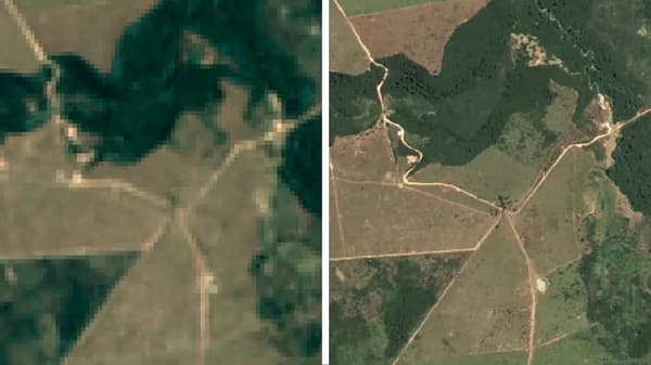
In a groundbreaking collaboration, Google has partnered with the Brazilian government to develop a satellite imagery map aimed at protecting the country’s vast and vital forests. This initiative not only represents a significant technological advancement but also carries profound implications for global environmental policy, economic sustainability, and climate change mitigation.

Quick Take
| Feature | Description |
|---|---|
| Partnership | Google and the Brazilian government |
| Objective | Develop satellite imagery for forest protection |
| Technology Used | Advanced satellite imagery and mapping tools |
| Expected Impact | Greater transparency in deforestation rates and enhanced conservation efforts |
Historical Context of Deforestation in Brazil
Brazil boasts the largest portion of the Amazon rainforest, often referred to as the